Mt. Whitney dayhike for September 12, 2006
Distance: 22 miles
Start: 12:40 a.m.
Summit: 9:10 a.m. (20 minute summit stay)
Finish: 3:51 p.m.
Total: 15 hours 11 minutes
Horacio (co-worker for the Whitney hike on 08/10/06) and I hit the trail and reached the lofty summit of Mecca West. His first summit on his second attempt and my fifth summit.
12:40 a.m.: Start from the old stock trail with its 28 switchbacks. I decide to count switchbacks along certain portions of the trail to keep my mind busy. It was agreed that we keep the conversation to a minimum while making the ascent. Conservation of energy.
1:03 a.m.: John Muir Wilderness sign on the Mt. Whitney Trail. There are 26 switchbacks from the JMW sign to the log crossing. Switchback #11 is the longest of them. We encounter two mule deer on switchback #18. Startled the bejeezus out of us as we did to them.
2:07 a.m.: The log crossing. Add one more switchback for a total of 27. We bump into a lone female backpacker at the other end of the crossing. Later found out that she was the disoriented hiker who was wandering around the John Muir Wilderness for 20 hours. We just exchanged greetings and went about our merry ways. She apparently suffered from knee problems and made it out safely to Whitney Portal.
2:15 a.m.: The Whitney Zone. Still. The waning gibbous moon casts its glow all around us. We rest on Lawrence Murphy Rock adjacent to the Whitney Zone. We are making excellent progress on the trail. We are going at a comfortable pace.
2:36 a.m.: Outpost Camp. I count 18 switchbacks from the Whitney Zone to Outpost Camp. Big Horn Park is to the right of us as we make our way to the camp area. There are a couple of tents off to either side of us as we make our way. We rock hop the stream crossing and make our way up another series of switchbacks. I do not bother to count. Maybe on the way down. Oftentimes, I lose sight of the trail only to recollect my thoughts and readjust my bearings to get me back on the trail. Hikers over the years have erected cairns to point the way and some have outlined the trail with carefully placed rocks to show the way.
4:00 a.m.: Trailside Meadows. No winter-like wind gusts like last time on August 10. Very calm. I keep thinking to myself if this is the way it is going to be all the way to the top. I am hoping such is the case.
4:56 a.m.: Trail Camp. The air is still. No wind. We rest on a rock to rest before the push up the 99 switchbacks.
5:10 a.m.: We head up the 99 switchbacks. I stop to fill up my Nalgene bottle at the spring on one of the switchbacks. Water is icy cold and refreshing. No need for filtration at this spring. It comes from the snowmelt. This water eventually flows into the lake adjacent to Trail Camp known to other Whitney hikers as the "Sierra Sewer."
5:58 a.m.: Cables. The melting snow has now turn to ice as the sun is now lower in the horizon. Water is frozen making the trail hazardous. There is about a boot-width of clear trail close to the cables. One misstep, one lapse of concentration, or one misplaced trekking pole means sliding down 800 foot slab of granite.
6:34 a.m.: Sunrise. What a sight to behold as the Sierra Nevada is awaken by the alpenglow. I can imagine how John Muir felt when he first trekked in this area. The wind starts to blow.
6:57 a.m.: Trail Crest. The last switchback is free and clear of any snow. The wind is coming from the east and is cold. We head down the MWT past the Trail Crest sign for shelter from the wind. There is an eerie dead silence, but the views were spectacular. Two boulders have fallen across the John Muir Trail since the last hike on August 10. We hook up with 8 other hikers on the John Muir Trail. It was their first hike for all of them. I give them advice on breathing and "breaking it down" meaning every 200 steeps, stop, rest, recover, continue. One hiker is complaining of hoarseness. He is chewing tobacco. Enough said. I offer him some Lifesaver candy. He turns down my request. The winds are gusty at the "windows." Horacio mentions his fingers are numb. I suggest to him that when we stop, he puts his gloved hands in his vest pockets. As we near Mt. Whitney, the wind is coming from the west. The winds are coming around Mt. Whitney from the Mountaineer's Route and hooking up with the winds from the east via the "windows" making the last mile to the summit very windy and cold. The snow "wedge" near the summit no longer exists.

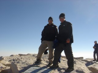
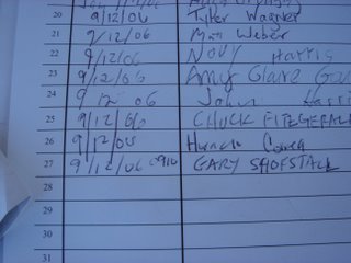
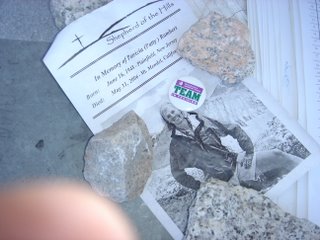
9:10 a.m.: Summit. The wind is blowing hard from the west. Horacio's watch said the temperature was 43°, but I imagine the wind chill to be hovering around freezing. I imagine the gusts to be between 20-25 miles per hour. Could have been 30 mph for all I know. There are 15 people at the summit. All first-timers. Anne, who was on my team in August and failed due to acute mountain sickness, reached the summit with another group. Her good friend Kristan, who I call Anne's "good luck charm," reached the summit as well. Both opted for the overnight trek. I am happy for Anne since this was her third attempt. She finally made it and deservedly so. After hiking to the tops of San Jacinto, San Antonio, and San Gorgonio, she finally did it. We take our pictures at the trail sign and at the summit marker. We also take pictures of us while signing in the summit log. I leave behind a pamphlet from Patty Rambert's memorial service as well as a Team In Training button.

9:30 a.m.: Down we go. The "getting down is mandatory" part begins. Horacio complaining of headaches. Acute mountain sickness. I am feeling no ill-effects of AMS.
11:08 a.m.: Trail Crest. I never liked the half-mile from the junction of the JMT to TC. I am sure all Whitney hikers can attest to that! It seems to get steeper every time I go.
12:32 p.m.: Done with the 99 switchbacks. There is a rock slide at the cables. I dive into the wall to avoid falling debris only to find myself landing on the ice and sliding to the edge. Not a very wise decision on my part, but there wasn't any other option. Had I gone over the edge, I would have grabbed the cables thus preventing a very long "slide for life." I proceed down to the end of the cables and turn around to check on Horacio. I was looking up to see if there was a hiker up higher on the switchbacks causing the debris to fall. There wasn't one. Horacio makes it past the cables without incident. There is a hiker behind him and he is hit on his pack by a large chunk of falling debris. I ask if he is okay and he said yes. A nanosecond earlier and he would have been knocked unconscious and possibly killed. Talk about a close call. His two hiking buddies also witnessed the event.
12:37 p.m.: Trail Camp. We are halfway there. The toughest six miles are yet to come, because you can see the trail below in front of you and every step doesn't seem like you are getting any closer. I take this time to take off some gear to put in my pack and I apply sunscreen to my neck and face. I am still wearing my lower black thermals and a long-sleeved Arcteryx shirt. Although a bit warm, I am still comfortable. After all, only six more miles!
1:17 p.m.: Trailside Meadows. Horacio's feet and legs are hurting. I am holding up well. My back was twinging a little, but there was no cause for concern. I spot a marmot. It would be the only marmot I would see along the entire trail. We meet several of backpackers heading up the trail. They ask how far it is to Trail Camp and I tell them it is another mile. They heave a sigh and continue to push on. Between Trailside Meadows and Mirror Lake, another hiker passed us by on his descent and then stopped to ask us about our start time and when we reached the summit. We told him. Then this gentlemen proceeds to boast of his start time of 3:00 a.m. and reaching the summit at 10:00 a.m. Okay, so you reach the summit in 7 hours, so what? I know of someone who dayhikes the Mt. Whitney Trail twice in one day, can get to the top in 3 hours and 42 minutes, comes back down, rests for 30 minutes to change his socks, started hiking when he was 50, has reached the summit 50 plus times since then, is probably over 60-years-old, rides a stationary bike to train for Whitney, carries a Nalgene bottle (no filter) with Gookinade, doesn't carry a pack and doesn't run during the entire time. If there is anyone to boast or brag, it would be Jack N. from San Diego.
2:15 p.m.: Outpost Camp. Another 3.8 miles to go. It is warm. Too warm. There is hardly any wind blowing at this point. Our hopes were to have a nice breeze to cool us off as we made our descent. Such was not the case. I can feel the sun's radiation off the granite. I apply more sunscreen.
2:41 p.m.: Leave the Whitney Zone. The last 2.8 miles and 54 switchbacks await us. Again, there is no cool breeze. Just dead air. I ponder whether to head down the Mt. Whitney Trail to the trailhead or just head down the old stock trail. Went down the stock trail.
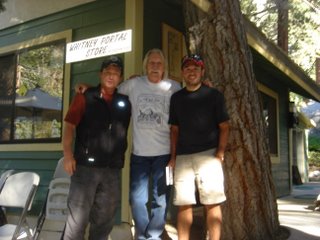
3:51 p.m.: Finish. Fifteen hours and 11 minutes on the trail. We never saw one ranger. We pass by the Whitney Portal Store
Gear: CamelBak Commander backpack with one Nalgene bottle, balaclava, sunglasses, Buff headband, Mountain Hardwear Dome Perignon hat, The North Face Paramount convertible pants, Denali vest and Pamir Windstopper gloves, Arcteryx long-sleeve, REI Lightweight MTS Long-Sleeve Zip-T, Marmot PreCip shells and DriClime jacket, REI long underwear, Ace knee braces, Montrail Comp hiking boots, Smartwool merino wool socks, Leki Super Makalu Ergo SLS trekking poles, duct tape, lip balm, sunscreen, M&M peanuts, Gookinade.
Notes: We came prepared. Once before, never again. Horacio packed only 2 liters of water for the entire trip. I believe this was the cause of his headaches on the descent due to the lack of hydration. The windy conditions were similar to my first Whitney summit in August 2004. The North Face Denali vest was instrumental in keeping me warm during the ascent up the 99s to the summit and back to Trail Crest. Snacking on grapes is highly recommended while acclimatizing for hydration and nutrients. Oranges are good, too. M&M peanuts are a lot better than mini Snickers for snacking on the trail. As they used to say, "Melts in your mouth, not in your hands." I can add to that: "...not in your backpack or shirt or pants pockets..." A teaspoonful of Gookinade in a liter of water makes a great pick-me-up after a grueling 22 miles on the trail. Lifesaver candy is great for the last 2.5 miles to the summit. You can also substitute lemon drops. THERE ARE A LOT OF SWITCHBACKS! Someone said there was 150. Wrong! I think the number is OVER to 200 if you also consider the old stock trail switchbacks.

I dedicated the hike to Patty Rambert who tragically lost her life on a mountaineering adventure on May 31, 2006 (see the June 16, 2006 post). I also dedicated this hike to all of my friends who reached the summit of Whitney with or without me over the course of the years: Joe, Mike B., Kandy, Dave and Jane, Erin, Jonathan, Tonya, Adrienne, Joe McK, Francisco. Horacio is the latest addition! I hope to add to this list. All of you done did good!
Many thanks this year to Garv and Heather and her friend Cathy; Mountain Joe; Mike B.; Kandy; Dave and Jane; Erin; Horacio and Kelly; Kindra; Amy M.; Michael B., Anne and Kristan; Dawn; members of my "family;" my doctors Dr. John S., Dr. Maurice C., and Dr. Farzad M.; the crew at the Whitney Portal Store, the staff at Dow Villa Motel, Miller's Towing, Pizza Factory, High Sierra Cafe, Totem Cafe, Pearsonville Shell, REI, Adventure 16 and last but not least the spirit of Danu Sherpa! It sure was a blast trekking up to the summits of San Gorgonio, San Jacinto, San Antonio, Mt. Wilson, Santiago Peak, Baden-Powell and the "little" walks in Crystal Cove State Park to prepare for "Mecca West."

I am contemplating a return to Mt. Whitney in mid-October. Should be some snow on the ground by then and permits shouldn't be a problem to obtain! Besides, who couldn't resist an order of Whitney Portal Fries to close out the 2006 hiking season!

 Erin reached the top of the 10,649 foot peak along with my other friends. It was her fourth peak "bagged." The others were Baden-Powell (9,399), San Jacinto (10,834), Mt. Whitney (14,497). Four down, 96 more to go.
 Francisco, Helen, Kim, Joe, Paul and me.
 The group started under the cover of darkness at 6:08 a.m. We had a couple of rest stops in between to get in and out of our extra layers.
  We rested at Limber Pine Bench before making the last 2.2 miles to the summit.


