Sunday, October 22, 2006

ICE HOUSE CANYON AND SADDLE

Looking down Icehouse Canyon and towards Icehouse Saddle from Chapman Trail.

Went on a hike with Kandy through Icehouse Canyon to observe the fall colors. Kandy made it to the top of Mt. Whitney this past August. We often discuss hiking together, but our schedules often conflict with other commitments. This time our schedules finally came to being.

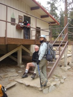
Kandy along the Icehouse Canyon Trail

We started around 7:30 a.m. and took the Icehouse Canyon Trail all the way up to Icehouse Saddle. It was a little chilly at the start but as we made our way deeper and deeper into the canyon and as the sun started to rise over the saddle, things started to warm up. We stopped numerous times to take photos of the fall colors.

Pictures do this area an injustice. You have to be there to actually "feel" it.

Icehouse Canyon has a very remarkable history. There are remnants of an active past along the creek. There are foundations and chimneys where cabins once stood. In 1938, there was a large storm that created a flash flood 150 feet wide. The wall of water wiped out a majority of the cabins. Those who lost their homes in that flash flood decided never to rebuild. There are cabins that exist today along certain parts of the creek. I do not know if those cabins are actually from that era.

After reaching the saddle at 9:30 a.m., we stayed for 30 minutes before heading down the narrow and infrequently used Chapman Trail all the way back down to the canyon floor. Chapman Trail provides magnificent views of the surrounding mountains and the canyon from the north side of Icehouse Canyon. Certain areas of the trail remind me of certain sections of the Mt. Whitney Trail and Holy Jim Trail in Orange County. You do have to watch your step in certain sections. I stopped often to look for the elusive bighorn sheep along the mountainsides and did not see any.

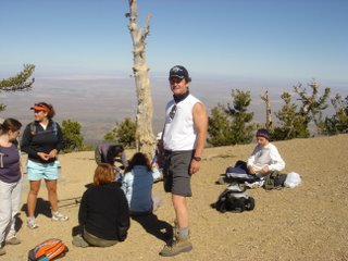
We stopped a hiker to see if he would oblige in taking our photograph.

The following two pictures were taken by Kandy. She has a remarkable eye for detail.


We concluded our hike at 12:45 p.m. We calculated to have hiked 9 miles.

Sunrise over Icehouse Saddle.

We stopped at the Baldy Village Inn to grab some lunch. As I took care of the lunch bill (she drove), Kandy went over to the visitor center. After paying the tab, I went over there to look around myself since I hardly do. We obtained information from the ranger as to where we can best observe bighorn sheep in their natural habitat. The ranger said that you can best see them from across the trout ponds on the way to the Icehouse Canyon trailhead.

Next time...

Saturday, October 21, 2006

MT. BADEN-POWELL "FAST BLAST"

Mt. Baden-Powell again. This time at a more quicker pace up and down.

I hiked the 8-mile roundtrip with a 30-pound pack in 3 hours and 20 minutes. Two hours up and 1 hour 20 minutes down.

I counted the number of switchbacks on the way up. For every switchback, I picked up a very small pebble. When I got to the last switchback before the final push along the ridgeline and to the summit, I emptied my pockets. I counted 39 pebbles. There are two switchbacks to go to the summit making it a total of 41. That confirms the reports of the number of switchbacks. Now, I am convinced. That's a lot of switchbacks in four miles.

We started the hike at 9:20 a.m. and reached the summit at 11:20 a.m. Stayed at the summit for a little over an hour to just relax, take photos, and take it all in. For many in the group it was their very first summit of Baden-Powell. For others it was their very first hike! They did remarkably well! At the beginning they said they were slow. Hah!

I was the designated "sweeper." I was the last guy up because I stayed with my carpooler, Noelle who having problems. She wasn't having problems with altitude, just with the exertion. I kept giving her words of encouragement. One of the members of the hiking group said it was another half mile. I told Noelle that when she reaches the top of these series of switchbacks, there was a ridgeline and then the summit within one-quarter of a mile.

When she saw the summit in sight from the ridgeline, she picked up her pace a little bit and started up the last two strenuous switchbacks. I told her break it down and to rest every 10 steps if she needed to. Well, she made it.


Many of the hiking party ate their lunch, climbed trees, took photos, remarked about the views, and had a great time at the summit. I pointed out to some members of the group the surrounding peaks. It was amazing we could see San Jacinto off in the distance. I pointed out Olancha Peak in the Sierra Nevada as well as Humphreys Peak near Flagstaff, Arizona.

We waited for four members of another hiking party who started from the same trailhead at 7:00 a.m. and start from the Bighorn Mine and ascend up the Class 2-3 route along the ridgeline to Baden-Powell's summit. All four members of that party made it safely.

We started descent at 12:25 p.m. and finished at 2:45 p.m.

After the hike, some of us stopped by Mile High Pizza in Wrightwood and celebrated with sodas and pizza. There are only two long tables in the establishment and we occupied both tables.


Vincent Gap: 6,565 feet
Summit: 9,399 feet
Elevation change: 2,834
EC per mile: 708.5 ft / mi.
Switchbacks (confirmed): 41

Gear: Camelbak Commander pack, The North Face convertible pants, REI wicking shirts, TNF Apex and Denali vests, Marmot DriClime and PreCip shells, wool socks, Montrail hightops, Leki trekking poles, water (4 liters).

Notes: Trail anorexia. Did not eat anything the entire way. Did have a banana and two McDonald's hash browns before the start of the hike. Lifesaver candies are great for mountain trails. No issues. Bear and bighorn sheep scat at around the 18th switchback and at the 37th.

Saturday, October 14, 2006

FARTLEK

Debra and I carpooled to hook up with Joe and Mike who were already in the Palm Springs area and we got to the tram road at 7:00 a.m. When we arrived there was a cycling event and no traffic was allowed until 8:30 a.m. and the first tram up was at 9:00 a.m. this weekend. I informed Joe of the situation on his cellphone. He said he and Mike will be arriving in about 20 minutes.

After arriving and chatting for a while we decided to head to Carl’s Jr. to grab some coffee and grub and wait for the road to open up. By this time, the winds were picking up in the desert and you could see the clouds moving in from the west through the valley and over San Jacinto. From what I could see from the visitors’ center, there was no snow on San Jacinto. Maybe there was snow on the west side.

After downing some grub at Carl's Jr. we drove back to the road to take our place in line. In front of us was a school bus full of high school ROTC students. We needed to get around that bus get to the terminal before they do. We managed to pass that bus about tw0-thirds up the road. We parked our vehicles and walked briskly up to the front of the terminal just in time. As soon as we got there, that bus pulled up in front of terminal.

We took the first tram up. It was a little chilly at the top, but there was no snow anywhere to be seen. I had brought my cold weather gear including ice ax and snowshoes in my Gregory Z-Pack. Maybe there was a slight chance of measurable snow.

Joe (top), Mike and Debra

Thank God there weren't any fashion police on San Jacinto!

We filled out our permits at the ranger station and headed out for our fartlek loop. Today was not going to be a summit day to the top of San Jacinto. Today was just a loop with a few strenuous grades.

About a mile into the trail, Debra was feeling nauseous. So, instead of hiking any further, it was decided that Debra go back to the tram station. I had given her an extra set of car keys in case she needed to head down to lower elevation. It was decided that after I escorted Debra back to the station, Joe and Mike would proceed along the loop while I would take the trail to Wellman’s Divide and hook up with them somewhere in the great unknown in two to two and a half hours.

I passed a few people on the way up. I couldn’t help but notice one gentleman who was slightly rotund and carrying nothing but a camera sitting on one of the many fallen logs. No pack and no water and his breathing was labored. I asked if he was okay and he nodded positively. There was this group of three Asians (2 men and 1 woman) about 200 yards from WD. They were dressed inappropriately considering the current climate conditions.

I got to WD around 1:00 p.m. No snow on the other side of the mountain. The wind was blowing up and the clouds were moving in. It was cold but not too cold to bring out my fleece jacket or gloves. Then, it started to snow lightly. Cool! Not enough to warrant wearing any snowshoes or bringing out the ice ax. I proceeded down to a little on the other side. I stopped and sat about 300 yards from the divide for a moment to assess the situation. There was this Korean couple heading down into the white abyss. They, too, were not appropriately dressed for the current conditions. Some people just don’t get it!

I could not see nor hear Joe or Mike due to the cloud cover and winds. It was about 1:30 p.m. and it has been three hours since I saw the two of them. I decided I would turn around. I have a simple rule of thumb that if I am not where I want to be between 1:00-1:30 p.m., I turn around. When I got back up to WD, it felt like the temperature dropped 10° in a matter of minutes! My fingers were cold, but I did not break out the gloves since the temperatures were tolerable.

I saw the group of three proceed up to the summit. They could not see me but I could hear them. I could not see the summit due to the cloud cover. I just shook my head.

On my way down I passed the rotund gentleman again. He didn’t make much headway from the last time I saw him. I asked what he was trying to accomplish and he said he wanted to get pictures from WD and then return to the terminal. I told him it was a bit windy up there, there was some snow flurries and there are no photo opportunities today because it was nothing but white. There was no snow falling on us at this point since we were under the trees and the air was still. I cautioned him then proceeded down while he continued up.

About 10 minutes later, large flakes started to gently fall. Maybe Mr. Big Guy got what he wanted or decided that what I told him was the truth.

I got to Round Valley and there were a couple of ranger volunteers turning back people not appropriately dressed. I told one of them that I had two friends on the trail, and that there was a group of three proceeding to the summit and one going to Wellman’s Divide. I passed a few people going up to camp at Round Valley and weather the storm. I hope some snow fell to make their backpacking trek a memorable one.

I got back to the tram station and could not find Debra. I did one sweep. Nothing. Then as I turned back around, there she was sitting at one of the tables. I had a couple of beers and kept looking from the station to located Joe and Mike. I did not see them. Of course, I became concerned, but Joe and Mike are experienced hikers. Debra and I headed down to the parking lot and I left a note on Mike’s windshield and I left a voicemail message on Joe’s cellphone.

Joe and Mike eventually made it down safely.

I had my digital camera in one of the cargo pockets in my convertible trousers. Poor decision. My camera was dead. The power drained due to the cold temperatures. I was unable to get any photos from WD.

Monday, October 09, 2006

"FALL" CONDTIONS

Fall Conditions on the Mt. Whitney Trail

For those of you interested in trying to climb Mt. Whitney this fall you should be aware of current conditions, and more importantly how to interpret those conditions to help you decide how to make decisions with safety in mind to prevent a fatal "fall."

Snow is now present on Mt. Whitney and it will not melt away until late spring or early summer. You can count on negotiating a snow covered trail from, at minimum, somewhere above Trail Camp until Trail Crest.

From the cables until Trail Crest there are hazardous areas where a slip can turn into a fall, that can lead to an injury or fatality. This section is part of most of us refer to as the “99 Switchbacks.”

When the area receives more storms, you can count on snow lower and higher on the route.

Given these conditions there are certain things to keep in mind if you decide to attempt climbing Mt. Whitney via the Main Trail. This list is not exhaustive but is a good place to start:

(1) Recognize that your ascent will take longer than it would if the trail was dry. Plan extra time into your itinerary to account for this.

(2a) Realize that current conditions require climbers to have learned and practiced several mountaineering skills, which include self arrest with an ice axe (this is how you would attempt to stop yourself in the event of a slip on the hard snow and ice), how to walk with crampons on, and how to efficiently climb up and down snow slopes.

(2b) This means that ski poles are no substitute for an ice axe. Ski poles are great aids in walking. Going up hill they are like a portable hand rail. On the down hill they help reduce some of the jarring to hiker’s knees. They will do nothing to help stop a person in case of a fall. Yes, some ski poles are made with self arrest grips. This is no substitute for an ice axe.

(3a) The slope between Trail Camp and Trail Crest is north facing. This means it loses sun exposure early in the day. You can be on this slope during a warm sunny day and find the snow comfortable to walk on, but once the sun leaves this slope the snow will become firm, hard, and slick. It will stay that way until the sun hits it again, which might be the next day, or it might take several days if clouds obscure direct rays from the sun. Even with direct sun exposure the conditions could still be firm, hard, and slick.

(3b) Be prepared to climb on firm, hard, and slick snow. If you find yourself on this slope after 2:00 p.m. (when the sun begins leaving this area) you need to be prepared to negotiate increasingly firm, hard, and slick snow conditions.

(4a) Glissading from Trail Crest is not a safe option. It doesn’t matter if you see tracks from people who have previously done it. Among those who contributed to the current track includes one person who lost his life from the decision to glissade there.

(4b) People have tried glissading here for years. Understand that this slope is subtly angled in such a way that it can pull an unsuspecting mountaineer slowly to the left, which can make you end up slamming into the rocks at a high rate of speed. There have been many injuries and fatalities due to people glissading here.

(4c) If you decide to glissade anywhere else on any mountain remove your crampons. Glissading with crampons is NEVER an option. You run a high chance of injuring an ankle, a leg, or worse. It is poor mountaineering technique to do this anywhere and at any time.

(5a) Remember that the summit should not be your primary goal. Your first goal is to get back to the parking lot safely. If you can stay within that margin of safety then the summit is your second goal. This means that just because somebody else decided to ascend in questionable conditions, it should not determine what you decide to do. You need to make your decisions based on known skills and the ability of your group.

Getting to the top is optional...getting down is mandatory.