January 2: First major storm of the year to hit Southern California.
January 5: The "shoebox" is sold.
February 1: I lose a good friend and Fugowhee softball teammate, Paul, to heart failure. His death was a shock to all of us. We will miss him.
February 4: I move some household goods into my apartment. I spend my last night in the "shoebox." My back goes out. Painful. I drive myself to the ER only to return home without seeing an ER doctor.
February 5: Movers.
February 5: Pittsburgh Steelers defeat the Seattle Seahawks, 21-10, in Superbowl XL.
February 7: My good friend Paul is laid to rest.
February 14: Receive disbursements from the sale of the "shoebox."
February 24: My first of three epidurals.
March 10: The second of three epidurals.
March 11: Kindra takes me to the ER after I experience excruciating pain all day. I was given the hypo version of Dilaudid.
March 12: First laptop at Circuit City. Still feeling the Dilaudid.
March 14: The pain in my right leg mysteriously "disappears" for the entire day.
March 20: Japan beats Cuba, 10-6, in the inaugural World Baseball Classic championship at Petco Park in San Diego.
March 24: The third and final epidural.
March 26: New computer.
March 31: The neurologist appointment. No surgery required. "Enjoy your (Whitney) hike in August," he says.
April 1: "Trepidation Trek" along Sam Merrill Trail with Joe. First hike of the year. Getting my legs to work on the ascents was a tremendous undertaking due to my "inactive" status.
April 2: Pacific Daylight Savings Time. 2007 will be in March.
April 6: The inaugural Thursday Night hike in Crystal Cove State Park.
April 15: "Trepidation Trek II" hike up San Antonio Road past the utility building with snowshoes.
April 29: Summit of Santiago Peak (5,687) via Holy Jim Trail with Garv, Joe, Heather, Kathy, Mike.
May 13: Snow Travel School in Bishop, CA. Convict Lake northwest of Bishop.
May 20: Chino Air Show with Ken.
May 21: Summit of Mt. Wilson (5,680') with Dave and Jane. Fantastic people.
May 29: Memorial Day.
June 10: Summit of San Jacinto (10,834') via The Easy Way with Dave, Kelly and his son, Ryan.
June 11: Summit of Baden-Powell (9,399') via Vincent Gap.
June 12: Purchased a camper shell. No more Holiday Inn Express!
June 17: Summit of Baden-Powell (9,399') via Vincent Gap. Erin's very first summit of any mountain.
June 18: Summit of Mt. Baldy (10,064') via Baldy Bowl Trail.
July 2: Failed summit attempt of White Mountain Peak (14,246'). Keiko has AMS.
July 8: Summit of San Gorgonio (11,501') via Vivian Creek with Dave and Jane. Their first summit.
July 23: Summit of San Jacinto (10,834') via The Easy Way.
July 29: Failed summit attempt of San Bernardino Peak due to storm conditions on the mountaintop.
August 10: Fourth Mt. Whitney summit (day hike) with Erin (her first). 17:05. Second longest 22-miler I have ever done.
August 11: Dave and Jane summit Whitney for their first time. First husband and wife team to hike to the top.
August 15: Kandy summits Whitney for her first time along with her hiking friend and daughter. First mother and daughter team to hike to the top.
September 8: Company golf tournament. Kicked some putt on the links!
September 12: Fifth Mt. Whitney summit (day hike) with Horacio (his first). 15:11.
September 23: Summit of San Bernardino Peak (10,649') via the SBP Trail. Erin bags her fourth peak of the year completing her "grand slam."
September 30: Summit of Mt. San Antonio (10,064') via the Baldy Bowl Trail.
October 7: Summit of Bighorn Peak (8,441') and Ontario Peak (8,693') via Ice House Canyon Trail.
October 21: Summit of Baden-Powell (9,399').
October 27: The "Anaheim Cardinals of St. Louis" defeat the Detroit Tigers, 4-2, to win the World Series 4 games to 1. David Eckstein is World Series MVP. Jim Edmonds, Scott Spiezio and Jeff Weaver (all former "Anaheim" Angels) get their coveted World Series hardware.
October 28: Summit of Twin Peaks East (7,761').
October 29: Pacific Standard Time. 2007 will be in early November.
November 18: Started trailrunning. Slow, but not easy.
December 3: ER. Tachycardia. Later diagnosed as a "panic attack." Wake up call.
December 25: Santa delivers a $20 REI gift card, a book entitled "No Shortcuts to the Top" by Ed Viesturs, and Dale Earnhardt Christmas ornaments. I volunteer at a homeless shelter to serve food and spread cheer. My heart felt good this day.
December 31: Final hike of the year at Crystal Cove State Park. San Gorgonio via Vivian Creek for New Year's Eve/Day summit.
And other notable events of 2006...
Sunday, December 31, 2006
Saturday, December 09, 2006
PANIC
Agoraphobia...
That is what my psychologist said last night. I had a panic attack last Sunday after my run, because I failed to continue taking my fluoxetine since Thanksgiving.
The good side is that I "probably" didn't have a "vapor lock" after all. The bad side is that I am possibly "chemically dependent" on fluoxetine. Great. I am now an official member of the great American society of pill-poppers. Got a medical problem, pop a pill.
The psych wrote another prescription for another anti-depressant but I am hesitant to get it. My little "reality check" on Sunday was enough to jolt me out of my current predicament.
I am going to ride this storm out. The only "pills" I want to pop are aspirins and vitamins.
As we grow older our mind and body start misfiring. Duh! Too bad I can't get a "tune up" for another 100,000 miles and replace my brain, blood, and lymphatic system.
It was a strange coincidence that there was a documentary on HBO this morning on panic attacks. Earl Campbell and Kim Basinger also have this "disorder."
Ah, a sign from a higher power...
Saturday, November 18, 2006
BACK
on the trails...running on them.
Trail running is something I always wanted to do because I see other people doing it. If they can do it, why can't I?
I ran at Crystal Cove State Park this morning. My first actual run since my back injury.
I was concerned since I still have the sciatica. How will my legs and back hold up?
I took my first steps up No Dogs. All uphill. Went to Overlook Point and turned around and started the downhill trek. Going downhill was a major concern since my legs could slip out from under me or my legs would collapse. No problems.
I made it to the parking lot and decided to push myself a little further by going down to El Moro Canyon and then up BFI to the wooden sign and turn around. From the wooden bridge to the top, I had to walk. Just too steep a grade to maintain a running pace. Coming back down BFI, I could feel my legs starting to "tighten up" so that was the cue to return to the parking lot..."you're done for the day."
I never stopped the entire way except to turn around and take it all in for just a few seconds.
My GPS registered 3.77 miles and 48:40. Not breakneck speed, but progress nonetheless. I hope to increase the distances one opportunity at a time.
It felt funny not hiking with a 30-pound pack on my back. Legs are a little sore. That's a given. Weakness leaving the body.
Tuesday, November 14, 2006
KNOW
Things I've always wanted to know and didn't...
In the 1400's a law was set forth in England that a man was allowed to beat his wife with a stick no thicker than his thumb. Hence we have "the rule of thumb."
Many years ago in Scotland, a new game was invented. It was ruled "Gentlemen Only...Ladies Forbidden"...and thus the word GOLF entered into the English language.
The first couple to be shown in bed together on primetime TV were Fred and Wilma Flintstone.
Every day more money is printed for Monopoly than the U.S. Treasury.
Men can read smaller print than women can; women can hear better.
Coca-Cola was originally green.
It is impossible to lick your elbow.
The state with the highest percentage of people who walk to work: Alaska
The percentage of Africa that is wilderness: 28%
The percentage of North America that is wilderness: 38%
The cost of raising a medium-size dog to the age of eleven: $6,400
The average number of people airborne over the U.S. in any given hour: 61,000
Intelligent people have more zinc and copper in their hair.
The first novel ever written on a typewriter: Tom Sawyer.
The San Francisco Cable cars are the only mobile National Monuments.
Each king in a deck of playing cards represents a great king from history:
Spades - King David
Hearts – Charlemagne
Clubs -Alexander, the Great
Diamonds - Julius Caesar
111,111,111 x 111,111,111 = 12,345,678,987,654,321
If a statue in the park of a person on a horse has both front legs in the air, the person died in battle. If the horse has one front leg in the air the person died as a result of wounds received in battle. If the horse has all four legs on the ground, the person died of natural causes.
Only two people signed the Declaration of Independence on July 4th, John Hancock and Charles Thomson. Most of the rest signed on August 2, but the last signature wasn't added until 5 years later.
Q: Half of all Americans live within 50 miles of what?
A: Their birthplace
Q: Most boat owners name their boats. What is the most popular boat name requested?
A: Obsession
Q: If you were to spell out numbers, how far would you have to go until you would find the letter "A"?
A: One thousand
Q: What do bulletproof vests, fire escapes, windshield wipers, and laser printers all have in common?
A: All were invented by women.
Q: What is the only food that doesn't spoil?
A: Honey
Q: Which day are there more collect calls than any other day of the year?
A: Father's Day
In Shakespeare's time, mattresses were secured on bed frames by ropes. When you pulled on the ropes the mattress tightened, making the bed firmer to sleep on. Hence the phrase: "goodnight, sleep tight."
It was the accepted practice in Babylon 4,000 years ago that for a month after the wedding, the bride's father would supply his son-in-law with all the mead he could drink. Mead is a honey beer and because their calendar was lunar based, this period was called the honey month, which we know today as the honeymoon.
In English pubs, ale is ordered by pints and quarts. So in old England when customers got unruly, the bartender would yell at them "Mind your pints and quarts, and settle down." It's where we get the phrase "mind your P's and Q's."
Many years ago in England, pub frequenters had a whistle baked into the rim, or handle, of their ceramic cups. When they needed a refill, they used the whistle to get some service. "Wet your whistle" is the phrase inspired by this practice.
At least 75% of people who read this will try to lick their elbow!
Don't delete this just because it looks weird. Believe it or not, you can read it.
I cdnuolt blveiee taht I cluod aulaclty uesdnatnrd waht I was rdanieg. The phaonmneal pweor of the hmuan mnid aoccdrnig to rscheearch at Cmabrigde Uinervtisy, it deosn't mttaer in waht oredr the ltteers in a wrod are, the olny iprmoatnt tihng is taht the frist and lsat ltteer be in the rghit pclae. The rset can be a taotl mses and you can sitll raed it wouthit a porbelm. Tihs is bcuseae the huamn mnid deos not raed ervey lteter by istlef, but the wrod as a wlohe. Amzanig huh?
YOU KNOW YOU ARE LIVING IN 2006 when...
1. You accidentally enter your PIN on the microwave.
2. You haven't played solitaire with real cards in years.
3. You have a list of 15 phone numbers to reach your family of three.
4. You e-mail the person who works at the desk next to you.
5. Your reason for not staying in touch with friends and family is that they don't have e-mail addresses.
6. You pull up in your own driveway and use your cell phone to see if anyone is home to help you carry in the groceries.
7. Every commercial on television has a web site at the bottom of the screen.
8. Leaving the house without your cell phone, which you didn't even have; the first 20 or 30 (or 60) years of your life, is now a cause for panic and you turn around to go and get it.
10. You get up in the morning and go on line before getting your coffee.
11. You start tilting your head sideways to smile. : )
12. You're reading this and nodding and laughing.
13. Even worse, you know exactly to whom you are going to forward this message.
14. You are too busy to notice there was no #9 on this list.
15. You actually scrolled back up to check that there wasn't a #9 on this list.
Thursday, November 09, 2006
Sunday, October 22, 2006
ICE HOUSE CANYON AND SADDLE
 Looking down Icehouse Canyon and towards Icehouse Saddle from Chapman Trail.
Went on a hike with Kandy through Icehouse Canyon to observe the fall colors. Kandy made it to the top of Mt. Whitney this past August. We often discuss hiking together, but our schedules often conflict with other commitments. This time our schedules finally came to being.
 Kandy along the Icehouse Canyon Trail
We started around 7:30 a.m. and took the Icehouse Canyon Trail all the way up to Icehouse Saddle. It was a little chilly at the start but as we made our way deeper and deeper into the canyon and as the sun started to rise over the saddle, things started to warm up. We stopped numerous times to take photos of the fall colors.

Pictures do this area an injustice. You have to be there to actually "feel" it.
Icehouse Canyon has a very remarkable history. There are remnants of an active past along the creek. There are foundations and chimneys where cabins once stood. In 1938, there was a large storm that created a flash flood 150 feet wide. The wall of water wiped out a majority of the cabins. Those who lost their homes in that flash flood decided never to rebuild. There are cabins that exist today along certain parts of the creek. I do not know if those cabins are actually from that era.
After reaching the saddle at 9:30 a.m., we stayed for 30 minutes before heading down the narrow and infrequently used Chapman Trail all the way back down to the canyon floor. Chapman Trail provides magnificent views of the surrounding mountains and the canyon from the north side of Icehouse Canyon. Certain areas of the trail remind me of certain sections of the Mt. Whitney Trail and Holy Jim Trail in Orange County. You do have to watch your step in certain sections. I stopped often to look for the elusive bighorn sheep along the mountainsides and did not see any.
 We stopped a hiker to see if he would oblige in taking our photograph.
The following two pictures were taken by Kandy. She has a remarkable eye for detail.


We concluded our hike at 12:45 p.m. We calculated to have hiked 9 miles.

Sunrise over Icehouse Saddle.
We stopped at the Baldy Village Inn to grab some lunch. As I took care of the lunch bill (she drove), Kandy went over to the visitor center. After paying the tab, I went over there to look around myself since I hardly do. We obtained information from the ranger as to where we can best observe bighorn sheep in their natural habitat. The ranger said that you can best see them from across the trout ponds on the way to the Icehouse Canyon trailhead.
Next time...

Saturday, October 21, 2006
MT. BADEN-POWELL "FAST BLAST"
 Mt. Baden-Powell again. This time at a more quicker pace up and down.
I hiked the 8-mile roundtrip with a 30-pound pack in 3 hours and 20 minutes. Two hours up and 1 hour 20 minutes down.
I counted the number of switchbacks on the way up. For every switchback, I picked up a very small pebble. When I got to the last switchback before the final push along the ridgeline and to the summit, I emptied my pockets. I counted 39 pebbles. There are two switchbacks to go to the summit making it a total of 41. That confirms the reports of the number of switchbacks. Now, I am convinced. That's a lot of switchbacks in four miles.
We started the hike at 9:20 a.m. and reached the summit at 11:20 a.m. Stayed at the summit for a little over an hour to just relax, take photos, and take it all in. For many in the group it was their very first summit of Baden-Powell. For others it was their very first hike! They did remarkably well! At the beginning they said they were slow. Hah!
I was the designated "sweeper." I was the last guy up because I stayed with my carpooler, Noelle who having problems. She wasn't having problems with altitude, just with the exertion. I kept giving her words of encouragement. One of the members of the hiking group said it was another half mile. I told Noelle that when she reaches the top of these series of switchbacks, there was a ridgeline and then the summit within one-quarter of a mile.
When she saw the summit in sight from the ridgeline, she picked up her pace a little bit and started up the last two strenuous switchbacks. I told her break it down and to rest every 10 steps if she needed to. Well, she made it.

Many of the hiking party ate their lunch, climbed trees, took photos, remarked about the views, and had a great time at the summit. I pointed out to some members of the group the surrounding peaks. It was amazing we could see San Jacinto off in the distance. I pointed out Olancha Peak in the Sierra Nevada as well as Humphreys Peak near Flagstaff, Arizona.
We waited for four members of another hiking party who started from the same trailhead at 7:00 a.m. and start from the Bighorn Mine and ascend up the Class 2-3 route along the ridgeline to Baden-Powell's summit. All four members of that party made it safely.
We started descent at 12:25 p.m. and finished at 2:45 p.m.
After the hike, some of us stopped by Mile High Pizza in Wrightwood and celebrated with sodas and pizza. There are only two long tables in the establishment and we occupied both tables.

Vincent Gap: 6,565 feet
Summit: 9,399 feet
Elevation change: 2,834
EC per mile: 708.5 ft / mi.
Switchbacks (confirmed): 41
Gear: Camelbak Commander pack, The North Face convertible pants, REI wicking shirts, TNF Apex and Denali vests, Marmot DriClime and PreCip shells, wool socks, Montrail hightops, Leki trekking poles, water (4 liters).
Notes: Trail anorexia. Did not eat anything the entire way. Did have a banana and two McDonald's hash browns before the start of the hike. Lifesaver candies are great for mountain trails. No issues. Bear and bighorn sheep scat at around the 18th switchback and at the 37th.

Saturday, October 14, 2006
FARTLEK
Debra and I carpooled to hook up with Joe and Mike who were already in the Palm Springs area and we got to the tram road at 7:00 a.m. When we arrived there was a cycling event and no traffic was allowed until 8:30 a.m. and the first tram up was at 9:00 a.m. this weekend. I informed Joe of the situation on his cellphone. He said he and Mike will be arriving in about 20 minutes.
After arriving and chatting for a while we decided to head to Carl’s Jr. to grab some coffee and grub and wait for the road to open up. By this time, the winds were picking up in the desert and you could see the clouds moving in from the west through the valley and over San Jacinto. From what I could see from the visitors’ center, there was no snow on San Jacinto. Maybe there was snow on the west side.
After downing some grub at Carl's Jr. we drove back to the road to take our place in line. In front of us was a school bus full of high school ROTC students. We needed to get around that bus get to the terminal before they do. We managed to pass that bus about tw0-thirds up the road. We parked our vehicles and walked briskly up to the front of the terminal just in time. As soon as we got there, that bus pulled up in front of terminal.
We took the first tram up. It was a little chilly at the top, but there was no snow anywhere to be seen. I had brought my cold weather gear including ice ax and snowshoes in my Gregory Z-Pack. Maybe there was a slight chance of measurable snow.
 Joe (top), Mike and Debra
 Thank God there weren't any fashion police on San Jacinto!
We filled out our permits at the ranger station and headed out for our fartlek loop. Today was not going to be a summit day to the top of San Jacinto. Today was just a loop with a few strenuous grades.
About a mile into the trail, Debra was feeling nauseous. So, instead of hiking any further, it was decided that Debra go back to the tram station. I had given her an extra set of car keys in case she needed to head down to lower elevation. It was decided that after I escorted Debra back to the station, Joe and Mike would proceed along the loop while I would take the trail to Wellman’s Divide and hook up with them somewhere in the great unknown in two to two and a half hours.
I passed a few people on the way up. I couldn’t help but notice one gentleman who was slightly rotund and carrying nothing but a camera sitting on one of the many fallen logs. No pack and no water and his breathing was labored. I asked if he was okay and he nodded positively. There was this group of three Asians (2 men and 1 woman) about 200 yards from WD. They were dressed inappropriately considering the current climate conditions.
I got to WD around 1:00 p.m. No snow on the other side of the mountain. The wind was blowing up and the clouds were moving in. It was cold but not too cold to bring out my fleece jacket or gloves. Then, it started to snow lightly. Cool! Not enough to warrant wearing any snowshoes or bringing out the ice ax. I proceeded down to a little on the other side. I stopped and sat about 300 yards from the divide for a moment to assess the situation. There was this Korean couple heading down into the white abyss. They, too, were not appropriately dressed for the current conditions. Some people just don’t get it!
I could not see nor hear Joe or Mike due to the cloud cover and winds. It was about 1:30 p.m. and it has been three hours since I saw the two of them. I decided I would turn around. I have a simple rule of thumb that if I am not where I want to be between 1:00-1:30 p.m., I turn around. When I got back up to WD, it felt like the temperature dropped 10° in a matter of minutes! My fingers were cold, but I did not break out the gloves since the temperatures were tolerable.
I saw the group of three proceed up to the summit. They could not see me but I could hear them. I could not see the summit due to the cloud cover. I just shook my head.
On my way down I passed the rotund gentleman again. He didn’t make much headway from the last time I saw him. I asked what he was trying to accomplish and he said he wanted to get pictures from WD and then return to the terminal. I told him it was a bit windy up there, there was some snow flurries and there are no photo opportunities today because it was nothing but white. There was no snow falling on us at this point since we were under the trees and the air was still. I cautioned him then proceeded down while he continued up.
About 10 minutes later, large flakes started to gently fall. Maybe Mr. Big Guy got what he wanted or decided that what I told him was the truth.
I got to Round Valley and there were a couple of ranger volunteers turning back people not appropriately dressed. I told one of them that I had two friends on the trail, and that there was a group of three proceeding to the summit and one going to Wellman’s Divide. I passed a few people going up to camp at Round Valley and weather the storm. I hope some snow fell to make their backpacking trek a memorable one.
I got back to the tram station and could not find Debra. I did one sweep. Nothing. Then as I turned back around, there she was sitting at one of the tables. I had a couple of beers and kept looking from the station to located Joe and Mike. I did not see them. Of course, I became concerned, but Joe and Mike are experienced hikers. Debra and I headed down to the parking lot and I left a note on Mike’s windshield and I left a voicemail message on Joe’s cellphone.
Joe and Mike eventually made it down safely.
I had my digital camera in one of the cargo pockets in my convertible trousers. Poor decision. My camera was dead. The power drained due to the cold temperatures. I was unable to get any photos from WD.

Monday, October 09, 2006
"FALL" CONDTIONS
Fall Conditions on the Mt. Whitney Trail
For those of you interested in trying to climb Mt. Whitney this fall you should be aware of current conditions, and more importantly how to interpret those conditions to help you decide how to make decisions with safety in mind to prevent a fatal "fall."
Snow is now present on Mt. Whitney and it will not melt away until late spring or early summer. You can count on negotiating a snow covered trail from, at minimum, somewhere above Trail Camp until Trail Crest.
From the cables until Trail Crest there are hazardous areas where a slip can turn into a fall, that can lead to an injury or fatality. This section is part of most of us refer to as the “99 Switchbacks.”
When the area receives more storms, you can count on snow lower and higher on the route.
Given these conditions there are certain things to keep in mind if you decide to attempt climbing Mt. Whitney via the Main Trail. This list is not exhaustive but is a good place to start:
(1) Recognize that your ascent will take longer than it would if the trail was dry. Plan extra time into your itinerary to account for this.
(2a) Realize that current conditions require climbers to have learned and practiced several mountaineering skills, which include self arrest with an ice axe (this is how you would attempt to stop yourself in the event of a slip on the hard snow and ice), how to walk with crampons on, and how to efficiently climb up and down snow slopes.
(2b) This means that ski poles are no substitute for an ice axe. Ski poles are great aids in walking. Going up hill they are like a portable hand rail. On the down hill they help reduce some of the jarring to hiker’s knees. They will do nothing to help stop a person in case of a fall. Yes, some ski poles are made with self arrest grips. This is no substitute for an ice axe.
(3a) The slope between Trail Camp and Trail Crest is north facing. This means it loses sun exposure early in the day. You can be on this slope during a warm sunny day and find the snow comfortable to walk on, but once the sun leaves this slope the snow will become firm, hard, and slick. It will stay that way until the sun hits it again, which might be the next day, or it might take several days if clouds obscure direct rays from the sun. Even with direct sun exposure the conditions could still be firm, hard, and slick.
(3b) Be prepared to climb on firm, hard, and slick snow. If you find yourself on this slope after 2:00 p.m. (when the sun begins leaving this area) you need to be prepared to negotiate increasingly firm, hard, and slick snow conditions.
(4a) Glissading from Trail Crest is not a safe option. It doesn’t matter if you see tracks from people who have previously done it. Among those who contributed to the current track includes one person who lost his life from the decision to glissade there.
(4b) People have tried glissading here for years. Understand that this slope is subtly angled in such a way that it can pull an unsuspecting mountaineer slowly to the left, which can make you end up slamming into the rocks at a high rate of speed. There have been many injuries and fatalities due to people glissading here.
(4c) If you decide to glissade anywhere else on any mountain remove your crampons. Glissading with crampons is NEVER an option. You run a high chance of injuring an ankle, a leg, or worse. It is poor mountaineering technique to do this anywhere and at any time.
(5a) Remember that the summit should not be your primary goal. Your first goal is to get back to the parking lot safely. If you can stay within that margin of safety then the summit is your second goal. This means that just because somebody else decided to ascend in questionable conditions, it should not determine what you decide to do. You need to make your decisions based on known skills and the ability of your group.
Getting to the top is optional...getting down is mandatory.
Saturday, September 23, 2006
SAN BERNARDINO PEAK

The only peak Erin didn't summit back in July during her training for Mt. Whitney is no longer a "didn't" but a "did." Pay back. San Bernardino Peak is now under her belt.
 Erin reached the top of the 10,649 foot peak along with my other friends. It was her fourth peak "bagged." The others were Baden-Powell (9,399), San Jacinto (10,834), Mt. Whitney (14,497). Four down, 96 more to go.
 Francisco, Helen, Kim, Joe, Paul and me.
 The group started under the cover of darkness at 6:08 a.m. We had a couple of rest stops in between to get in and out of our extra layers.
  We rested at Limber Pine Bench before making the last 2.2 miles to the summit.
 Paul, Helen, Joe, Francisco and Kim at Stone Bench
We stopped at Stone Bench to take in the spectacular view of the Inland Empire as well as the surrounding mountains.
We reached the summit a 10:55 a.m. For Erin, Joe, Paul, Frank, and Kim it was their first summit of San Bernardino Peak.
Joe, Kim, Erin and I headed back down at 11:18 a.m. while the rest of the group stays to take it all in. Erin is experiencing ankle problems and dons her Teva sandals for the descent.
At Manzanita Springs we meet a park ranger. This is the first time on this trail I have seen a park ranger. She checks our permit and allows us to proceed.
We finished the hike at 2:38 p.m.
A total of 15.8 miles in 8.5 hours.
Gear: Arcteryx long-sleeve, REI Sahara convertible pants, Montrail high tops, Smartwool socks, Leki Super Makalu trekking poles, CamelBak Commander pack, The North Face vest and gloves, Buff headwear.
Lessons learned: Autumn has certain arrived. Time to start bringing the extra layers. Luckily I brought my gloves. Others did not. Plantain chips from Trader Joe's are AWESOME! Thank you, Helen!

Wednesday, September 13, 2006
A "FIFTH" OF WHITNEY SUMMIT

Mt. Whitney dayhike for September 12, 2006
Distance: 22 miles
Start: 12:40 a.m.
Summit: 9:10 a.m. (20 minute summit stay)
Finish: 3:51 p.m.
Total: 15 hours 11 minutes
Horacio (co-worker for the Whitney hike on 08/10/06) and I hit the trail and reached the lofty summit of Mecca West. His first summit on his second attempt and my fifth summit.
12:40 a.m.: Start from the old stock trail with its 28 switchbacks. I decide to count switchbacks along certain portions of the trail to keep my mind busy. It was agreed that we keep the conversation to a minimum while making the ascent. Conservation of energy.
1:03 a.m.: John Muir Wilderness sign on the Mt. Whitney Trail. There are 26 switchbacks from the JMW sign to the log crossing. Switchback #11 is the longest of them. We encounter two mule deer on switchback #18. Startled the bejeezus out of us as we did to them.
2:07 a.m.: The log crossing. Add one more switchback for a total of 27. We bump into a lone female backpacker at the other end of the crossing. Later found out that she was the disoriented hiker who was wandering around the John Muir Wilderness for 20 hours. We just exchanged greetings and went about our merry ways. She apparently suffered from knee problems and made it out safely to Whitney Portal.
2:15 a.m.: The Whitney Zone. Still. The waning gibbous moon casts its glow all around us. We rest on Lawrence Murphy Rock adjacent to the Whitney Zone. We are making excellent progress on the trail. We are going at a comfortable pace.
2:36 a.m.: Outpost Camp. I count 18 switchbacks from the Whitney Zone to Outpost Camp. Big Horn Park is to the right of us as we make our way to the camp area. There are a couple of tents off to either side of us as we make our way. We rock hop the stream crossing and make our way up another series of switchbacks. I do not bother to count. Maybe on the way down. Oftentimes, I lose sight of the trail only to recollect my thoughts and readjust my bearings to get me back on the trail. Hikers over the years have erected cairns to point the way and some have outlined the trail with carefully placed rocks to show the way.
4:00 a.m.: Trailside Meadows. No winter-like wind gusts like last time on August 10. Very calm. I keep thinking to myself if this is the way it is going to be all the way to the top. I am hoping such is the case.
4:56 a.m.: Trail Camp. The air is still. No wind. We rest on a rock to rest before the push up the 99 switchbacks.
5:10 a.m.: We head up the 99 switchbacks. I stop to fill up my Nalgene bottle at the spring on one of the switchbacks. Water is icy cold and refreshing. No need for filtration at this spring. It comes from the snowmelt. This water eventually flows into the lake adjacent to Trail Camp known to other Whitney hikers as the "Sierra Sewer."
5:58 a.m.: Cables. The melting snow has now turn to ice as the sun is now lower in the horizon. Water is frozen making the trail hazardous. There is about a boot-width of clear trail close to the cables. One misstep, one lapse of concentration, or one misplaced trekking pole means sliding down 800 foot slab of granite.
5:58 a.m.: Cables. The melting snow has now turn to ice as the sun is now lower in the horizon. Water is frozen making the trail hazardous. There is about a boot-width of clear trail close to the cables. One misstep, one lapse of concentration, or one misplaced trekking pole means sliding down 800 foot slab of granite.
6:34 a.m.: Sunrise. What a sight to behold as the Sierra Nevada is awaken by the alpenglow. I can imagine how John Muir felt when he first trekked in this area. The wind starts to blow.
6:57 a.m.: Trail Crest. The last switchback is free and clear of any snow. The wind is coming from the east and is cold. We head down the MWT past the Trail Crest sign for shelter from the wind. There is an eerie dead silence, but the views were spectacular. Two boulders have fallen across the John Muir Trail since the last hike on August 10. We hook up with 8 other hikers on the John Muir Trail. It was their first hike for all of them. I give them advice on breathing and "breaking it down" meaning every 200 steeps, stop, rest, recover, continue. One hiker is complaining of hoarseness. He is chewing tobacco. Enough said. I offer him some Lifesaver candy. He turns down my request. The winds are gusty at the "windows." Horacio mentions his fingers are numb. I suggest to him that when we stop, he puts his gloved hands in his vest pockets. As we near Mt. Whitney, the wind is coming from the west. The winds are coming around Mt. Whitney from the Mountaineer's Route and hooking up with the winds from the east via the "windows" making the last mile to the summit very windy and cold. The snow "wedge" near the summit no longer exists.
6:57 a.m.: Trail Crest. The last switchback is free and clear of any snow. The wind is coming from the east and is cold. We head down the MWT past the Trail Crest sign for shelter from the wind. There is an eerie dead silence, but the views were spectacular. Two boulders have fallen across the John Muir Trail since the last hike on August 10. We hook up with 8 other hikers on the John Muir Trail. It was their first hike for all of them. I give them advice on breathing and "breaking it down" meaning every 200 steeps, stop, rest, recover, continue. One hiker is complaining of hoarseness. He is chewing tobacco. Enough said. I offer him some Lifesaver candy. He turns down my request. The winds are gusty at the "windows." Horacio mentions his fingers are numb. I suggest to him that when we stop, he puts his gloved hands in his vest pockets. As we near Mt. Whitney, the wind is coming from the west. The winds are coming around Mt. Whitney from the Mountaineer's Route and hooking up with the winds from the east via the "windows" making the last mile to the summit very windy and cold. The snow "wedge" near the summit no longer exists.

9:10 a.m.: Summit. The wind is blowing hard from the west. Horacio's watch said the temperature was 43°, but I imagine the wind chill to be hovering around freezing. I imagine the gusts to be between 20-25 miles per hour. Could have been 30 mph for all I know. There are 15 people at the summit. All first-timers. Anne, who was on my team in August and failed due to acute mountain sickness, reached the summit with another group. Her good friend Kristan, who I call Anne's "good luck charm," reached the summit as well. Both opted for the overnight trek. I am happy for Anne since this was her third attempt. She finally made it and deservedly so. After hiking to the tops of San Jacinto, San Antonio, and San Gorgonio, she finally did it. We take our pictures at the trail sign and at the summit marker. We also take pictures of us while signing in the summit log. I leave behind a pamphlet from Patty Rambert's memorial service as well as a Team In Training button.

9:30 a.m.: Down we go. The "getting down is mandatory" part begins. Horacio complaining of headaches. Acute mountain sickness. I am feeling no ill-effects of AMS.
11:08 a.m.: Trail Crest. I never liked the half-mile from the junction of the JMT to TC. I am sure all Whitney hikers can attest to that! It seems to get steeper every time I go.
12:32 p.m.: Done with the 99 switchbacks. There is a rock slide at the cables. I dive into the wall to avoid falling debris only to find myself landing on the ice and sliding to the edge. Not a very wise decision on my part, but there wasn't any other option. Had I gone over the edge, I would have grabbed the cables thus preventing a very long "slide for life." I proceed down to the end of the cables and turn around to check on Horacio. I was looking up to see if there was a hiker up higher on the switchbacks causing the debris to fall. There wasn't one. Horacio makes it past the cables without incident. There is a hiker behind him and he is hit on his pack by a large chunk of falling debris. I ask if he is okay and he said yes. A nanosecond earlier and he would have been knocked unconscious and possibly killed. Talk about a close call. His two hiking buddies also witnessed the event.
12:37 p.m.: Trail Camp. We are halfway there. The toughest six miles are yet to come, because you can see the trail below in front of you and every step doesn't seem like you are getting any closer. I take this time to take off some gear to put in my pack and I apply sunscreen to my neck and face. I am still wearing my lower black thermals and a long-sleeved Arcteryx shirt. Although a bit warm, I am still comfortable. After all, only six more miles!
1:17 p.m.: Trailside Meadows. Horacio's feet and legs are hurting. I am holding up well. My back was twinging a little, but there was no cause for concern. I spot a marmot. It would be the only marmot I would see along the entire trail. We meet several of backpackers heading up the trail. They ask how far it is to Trail Camp and I tell them it is another mile. They heave a sigh and continue to push on. Between Trailside Meadows and Mirror Lake, another hiker passed us by on his descent and then stopped to ask us about our start time and when we reached the summit. We told him. Then this gentlemen proceeds to boast of his start time of 3:00 a.m. and reaching the summit at 10:00 a.m. Okay, so you reach the summit in 7 hours, so what? I know of someone who dayhikes the Mt. Whitney Trail twice in one day, can get to the top in 3 hours and 42 minutes, comes back down, rests for 30 minutes to change his socks, started hiking when he was 50, has reached the summit 50 plus times since then, is probably over 60-years-old, rides a stationary bike to train for Whitney, carries a Nalgene bottle (no filter) with Gookinade, doesn't carry a pack and doesn't run during the entire time. If there is anyone to boast or brag, it would be Jack N. from San Diego.
2:15 p.m.: Outpost Camp. Another 3.8 miles to go. It is warm. Too warm. There is hardly any wind blowing at this point. Our hopes were to have a nice breeze to cool us off as we made our descent. Such was not the case. I can feel the sun's radiation off the granite. I apply more sunscreen.
2:41 p.m.: Leave the Whitney Zone. The last 2.8 miles and 54 switchbacks await us. Again, there is no cool breeze. Just dead air. I ponder whether to head down the Mt. Whitney Trail to the trailhead or just head down the old stock trail. Went down the stock trail.
3:51 p.m.: Finish. Fifteen hours and 11 minutes on the trail. We never saw one ranger. We pass by the Whitney Portal Store
Gear: CamelBak Commander backpack with one Nalgene bottle, balaclava, sunglasses, Buff headband, Mountain Hardwear Dome Perignon hat, The North Face Paramount convertible pants, Denali vest and Pamir Windstopper gloves, Arcteryx long-sleeve, REI Lightweight MTS Long-Sleeve Zip-T, Marmot PreCip shells and DriClime jacket, REI long underwear, Ace knee braces, Montrail Comp hiking boots, Smartwool merino wool socks, Leki Super Makalu Ergo SLS trekking poles, duct tape, lip balm, sunscreen, M&M peanuts, Gookinade.
Notes: We came prepared. Once before, never again. Horacio packed only 2 liters of water for the entire trip. I believe this was the cause of his headaches on the descent due to the lack of hydration. The windy conditions were similar to my first Whitney summit in August 2004. The North Face Denali vest was instrumental in keeping me warm during the ascent up the 99s to the summit and back to Trail Crest. Snacking on grapes is highly recommended while acclimatizing for hydration and nutrients. Oranges are good, too. M&M peanuts are a lot better than mini Snickers for snacking on the trail. As they used to say, "Melts in your mouth, not in your hands." I can add to that: "...not in your backpack or shirt or pants pockets..." A teaspoonful of Gookinade in a liter of water makes a great pick-me-up after a grueling 22 miles on the trail. Lifesaver candy is great for the last 2.5 miles to the summit. You can also substitute lemon drops. THERE ARE A LOT OF SWITCHBACKS! Someone said there was 150. Wrong! I think the number is OVER to 200 if you also consider the old stock trail switchbacks.

I dedicated the hike to Patty Rambert who tragically lost her life on a mountaineering adventure on May 31, 2006 (see the June 16, 2006 post). I also dedicated this hike to all of my friends who reached the summit of Whitney with or without me over the course of the years: Joe, Mike B., Kandy, Dave and Jane, Erin, Jonathan, Tonya, Adrienne, Joe McK, Francisco. Horacio is the latest addition! I hope to add to this list. All of you done did good!
Many thanks this year to Garv and Heather and her friend Cathy; Mountain Joe; Mike B.; Kandy; Dave and Jane; Erin; Horacio and Kelly; Kindra; Amy M.; Michael B., Anne and Kristan; Dawn; members of my "family;" my doctors Dr. John S., Dr. Maurice C., and Dr. Farzad M.; the crew at the Whitney Portal Store, the staff at Dow Villa Motel, Miller's Towing, Pizza Factory, High Sierra Cafe, Totem Cafe, Pearsonville Shell, REI, Adventure 16 and last but not least the spirit of Danu Sherpa! It sure was a blast trekking up to the summits of San Gorgonio, San Jacinto, San Antonio, Mt. Wilson, Santiago Peak, Baden-Powell and the "little" walks in Crystal Cove State Park to prepare for "Mecca West."

I am contemplating a return to Mt. Whitney in mid-October. Should be some snow on the ground by then and permits shouldn't be a problem to obtain! Besides, who couldn't resist an order of Whitney Portal Fries to close out the 2006 hiking season!

Friday, September 08, 2006
MT. WHITNEY...AGAIN

Heading up the Mt. Whitney again for the second time this year.
I was fortunate enough to secure a campsite at Whitney Portal and thanks to TeamBruin I was able to secure a permit for Tuesday, September 12.
I called the Reservation Line on Wednesday, September 6 and asked about any permit availability. Fortunately there were ONLY 2 for September 12 and NONE for September 11. A lot of hikers I hear ask for that day in remembrance of the terrorist attack in 2001.

Horacio and I will drive up to Lone Pine on Sunday, August 10, to campsite #37 at the Whitney Portal Family Campgrounds.

Tuesday, August 15, 2006
TEAM DANCES WITH COYOTES
 Congratulations to Kandy and Team Dances With Coyotes (daughter Ashley and trail buddy Michael) on their successful summit of Mt. Whitney on August 15. It took them an 14 hours to do the 22 mile hike. Great job!
The following is a trip report from Kandy:
I cannot even describe how awesome Tuesday was. In summary . . .
12:25 am - on the trail. Temperature relatively mild compared to the howling winds and cold of last year. One other gentleman hiker slightly ahead of us. We immediately run into a woman coming down with a pack on her back and carrying a bear cannister. She didn't seem very happy and wasn't interested in talking to us . . .hope this isn't a bad omen.
1:25 am - the log bridge.
3:30 am - Trail Camp - I forgot to note times at the other notable spots like Outpost Camp. I was so focused on the hike itself. There was one tent visable off the trail. Somewhere just before Outpost, we passed two women who were also going up . . . and struggling. Somewhere past Outpost, we passed the gentleman we saw in the parking lot. He tried to keep up but we lost him in the dark.
The 20 minute stay at Trail Camp was miserable. The temperatures dropped miserably and the wind was blowing. Michael struggled some the last 30 minutes or so before camp, and had started to panic about the cold. Once he ate and we stuck "Heat Factory" packs all over our bodies (a life saver, those little things are!), he regrouped and we were off. Our lone hiker joined us for a bit while we were resting, and started up before us, but we quickly overtook him. The horizon started turning shades of orange and red about 1/2 way up the switchbacks and we were soon able to turn off our headlamps. We hit patches of ice which surprised me. I guess it really was cold!
I have no idea when we got to Trail Crest. The sun was just starting to paint the peaks. Unlike you, there was absolutely no wind. Cold though. I had nightmares about Trail Crest in what little sleep I got Monday night, but it wasn't as bad as I had envisioned. It really could have been worse, right? At some point in time, Michael pointed out the hut. I was immediately ecstatic that it was in sight, yet at the same time it looked soooooooooooooooooooooooo FARAWAY! Right after that, I started getting very emotional as there was no doubt that I was going to summit. Ashley turned around and I'm blubbering away that we were going to make it. Collected myself and marched on. Was absolutely amazed that while I wasn't jogging up, the altitude really didn't seem to be a problem. No problems breathing, no headache, no naseua. Michael & Ashley both said they were a bit lightheaded, but I was too pumped to feel anything but euphoria!
 7:30 am - Team Dances with Coyotes planted their feet on the summit. I immediately started dancing and screaming - scared the weeby-jeebies out of the 6 people already on the summit. It all seemed so surreal, especially since I didn't really feel all that tired. Cold at the top, but who noticed? I was too busy talking a mile a minute and taking pictures. We savored our triumph for about an hour and since no one was serving coffee, decided to start the second half of the hike. And that's when the misery set in.
My headache started before heading down the switchbacks, but it was managable with Advil. I was a bit apprehensive about going down the switchbacks, as downhill is problematic with my knee (I put my brace on before heading back down which helps). I have since decided that the switchbacks are best done in the dark . . .whether going up OR down. Then you cannot see that no matter how many steps you take, you are never, ever going to get to the end. EVER!
Since the ascent was in the dark, seeing the trail in the daylight was nice, but it also kept prompting me to say "we climbed up THAT?" Darkness was my friend . . .
The rest of the descent was uneventful but also never-ending. We left Trail Camp at 11:45 am. I was so prepared for a struggle going up and never really concentrated on going down. The final two miles past Lone Pine Lake were the longest and I was getting really crabby. My feet were throbbing. My legs ached. Even accused the good Lord of moving the parking lot. A group of strangers were standing at the "launching pad" as we crawled through at 2:30 pm and suddenly the pain went away and I started a-hollering and a-hooting. They all joined in and started applauding when they found out it was a one-dayer . . . a perfect end!
Your words of wisdom were a big part of our success. I still have a copy of the first e-mail you sent to me after I posted "Do you think I can do it?" Thank you so much for everything!
Friday, August 11, 2006
TEAM BRUIN
 Congratulations to Team Bruin on their successful summit of Mt. Whitney.
Danu Sherpa is very proud of both of you.
The following is a trip report:
Sorry for the long post, but it was an amazing day and we had a blast. 9 1/2 hours up and 5 down, with almost an hour and a half on the summit. Yeah, that's WAY too long up top, but we were feeling great.
After all was said and done, we experienced no nausea, no headaches, and no significant aches or pains. The day before the hike, I was fortunate to speak with Doug Thompson about the current trail conditions, recommended departure times, recent rescues, etc. What a valuable source of information that guy is ... hello and thanks again for your time, Doug.
The one bit of advice Doug offered was to start no earlier than 2:00 a.m., in light of the recent winds and cold temps up there. BruinJane and I had planned to start earlier than that, but opted for 2:30 a.m.
Acclimation: Arrived at the Portal on Tuesday, 8/8 for 2 1/2 days of pre-hike acclimatizing. On 8/9, we met up with Gary and his crew of seven for a quick trip up and over to the 10,000' Horseshoe Meadows. I absolutely believe that these pre-hike days at altitude were keys to our successful summit.
The Hike: Conditions at 2:30 a.m. couldn't have been better -- about 50F and slightly breezy. At the ends of their hikes the day before, RunRJoe and Gary reported very cold and windy trail conditions (thanks again for stopping by, Danu), so additional fleeces went into our packs. Just goes to show you that each day up there can be very, very different. Headlamps illuminated our path and the 92% full-moon illuminated the surroundings. The outer layers were shed by about Lone Pine Lake. By Trailside Meadow, they were back on. Better to stay warm than to try to get warm once cold.
We hit Trail Camp about daybreak and were surprised to run into Two-In-One-Day-Jack Northup (WHTNY N1) for THE SECOND TIME that day -- earlier Jack had passed us around Lone Pine Lake while on his first descent. (Enjoyed meeting and talking with you, Jack -- good luck to your ball team this year.) A short rest and many pictures of the alpenglow later, we pushed up the Switchbacks and reached Trail Crest about 10:00 a.m.
Without wind to worry about, the Windows are actually great photo ops. The trail is level and comfortably wide at those spots, and first-timers shouldn't be concerned -- BruinJane and I both thought that some other portions of the Whitney trail, as well as portions of Baldy's Devil's Backbone, provided tighter and more precipitous encounters which warranted greater attention.
Ran into Jack again at this point. Descent #2 for him. Darn that guy.
 Signed the register about noon, with a special nod to Danu (couldn't have done it without you, Sherp) and to 67Brickie (thanks for the push, Brick). Up top we were feeling surprisingly good.
 Took lots of pictures. Met and visited with Ranger Mark from Sequoia (thanks for taking some pics, Mark -- yours are on their way). Had a bite to eat. Called our respective fathers (yes, Verizon came through). It was a great experience.
The descent was safe and uneventful -- exactly what we were hoping for. No knee pain, whatsoever. We were shocked. Met up with our good friends Jimbo and Adele at the Portal Store for the best burgers, fries, and beers imaginable.
Food/Drink: We each started with full 100 oz. insulated bladders, and two empty Nalgenes. Just to be safe, I filled my Nalgenes on the way up the Switchbacks at the top of the "spring", which to me appears more like a melting snow bank. Despite having a filter in my pack, I took BobR's and others' advice and filled up unfiltered, straight from the source. Almost a week later, we're not experiencing any ill effects. We didn't hit these Nalgenes until the Switchbacks on our way down. Jane's two Nalgenes remained empty throughout the hike. As for food, on the trail we snacked periodically on GU, mini-Snickers pieces, PowerBars, and different trail mixes. At the summit, Jane ate her PB&J bagel.
Training: Started in March, and included several weekend hikes to altitude up Southern California peaks (Mt. Wilson, Mt. Lowe, Baldy via Village, Gorgonio via Vivian Creek, San Jacinto), many with Gary providing the necessary leadership, motivation, and descriptions of previous Whitney summits. Mid-week, we did countless 5-milers up to our local Henninger Flats and Echo Mountain. As has been stated by others many times, there's no better prep than hitting the trails, if for no other reason than getting used to the "down."
Observations/First-Timer Tips: Trail conditions. I was very impressed with how well maintained and clean it was, considering the pressure. Hat's off to those responsible for its maintenance and repair. Forest service members and volunteers (like GregF) should be commended. Cudos, big time.
Footwear: Despite a lot of recent discussion on the Board about this issue, I couldn't decide between using my trailrunners or traditional hiking boots. I decided to go with my mid-height Merrells instead of my Zamberlans. When I go again, I'm going with the Zamberlans. While the trailrunner-type Merrells worked just fine going up, the mid-trail rocks could be felt through the soles coming down -- no big deal, but an unwanted nuisance. Perhaps sole inserts would've helped.
Light gloves: Add 'em to your pack. With even the slightest early morning breeze up there, you'll be glad to have them.
Binoculars: Leave 'em campside. Unused added weight.
The Switchbacks: There are 99 and not 97. Those two near the bottom have enough of a change of direction where they should count. Just my opinion.
WAG bags: Are no big deal. 'Nuf said.
Backpacks: Our new Osprey Packs were incredibly comfortable and our backs stayed cool. Glad we had them. The waist belt pockets made for easy access to our food, lip balm, etc. And, no, I'm not affiliated with Osprey.
One last comment of appreciation to Doug, Earlene, and the Portal crew for their welcoming nature and obvious dedication to making the Whitney experience the best possible, especially for us first-timers. Thanks again.
Thursday, August 10, 2006
GRAND SLAM
 Front row: Me, Erin, Horacio
Back row: Kelly, Greg, Garv, Anne
Not pictured: Amy
Mt Whitney.
We did it. At least two of us anyways. Erin and I "bagged" Mecca West at 10:23 a.m. on Thursday, August 10, 2006. The 22-mile hike took us 17 hours and 5 minutes to complete.
We did it. At least two of us anyways. Erin and I "bagged" Mecca West at 10:23 a.m. on Thursday, August 10, 2006. The 22-mile hike took us 17 hours and 5 minutes to complete.
Thanks to my digital recorder, I was able to recount the day's events. Here is the trip report:
12:03 a.m.: All eight of us embark to the summit via the old stock trail. The skies are clear and the moon is at 97% illumination. Confidence is high. Garv is point. I am sweep.
12:25 a.m.: We reach the John Muir Wilderness sign. I have everyone turn off their headlamps to see the world around them as John Muir himself would have seen it.
12:43 a.m.: Greg drops from the hike. A very wise decision on his part. He was starting to slow down due to the exertion and altitude. I ask him if he were okay to find his way back. He nods in agreement. There are now seven of us.
1:32 a.m.: We reach the log crossing. Everyone makes it across safely without incident. There is a group of four hikers blocking the other side. They are "asked" to move aside to make way. That is no place to muster when you have seven eager hikers wanting to pass through.
1:40 a.m.: We enter the Whitney Zone. I point out "Bed Rock" that Lawrence Murphy slept and snored on back on August 6, 2004.
2:24 a.m.: We reach Outpost Camp.
4:35 a.m.: The winds are blowing as we near Trailside Meadows. My eyes water. I start to yawn. I feel disoriented. I want to lie down and sleep. We stop to top off our water supplies in our Camelbak bladders. The water is numbing cold.
5:15 a.m.: We reach Trail Camp. The exposed camp is windy and cold. Gusts are 25 mph. Windchill hovering near 30°. We are all not feeling well. We huddle against a rock as a windbreaker. Kelly is not feeling well. Horacio and Kelly decide to turn back. I can see in Horacio's eyes that he did not want to abort. He had no other choice. He did extremely well up to this point. I can sense the disappointment and frustration in his eyes. The team huddles close together to stay warm. I take out my space blanket and put it over Garv, Amy, Anne and Erin. I give Anne my Marmot Dri-Clime jacket to keep warm. I place their packs at their feet to shield from the cold wind. We anxiously wait for the sunrise to provide some sort of comfort. All of us are ill-prepared for the unusual weather conditions. I have a long-sleeved t-shirt, a short-sleeved t-shirt, a shirt, jacket, and balaclava. The key articles of clothing I am missing are my upper and lower shells and fleece jacket of which I took all out of my pack the night before to save weight. Bad decision on my part. I feel nauseous. I move away from the huddle to avoid vomiting on them. I decide to keep moving around. I start to feel better. I am constantly thinking of a way to keep moving to the summit. I am trying to find a way to motivate the group to keep pushing. I do not have any ideas or suggestions. I scamper along the rocks trying to find a solution. My thoughts turn negative. Now what do we do?
6:04 a.m.: The sun rises above the White Mountains. The alpenglow is something to behold. Erin gets up to take the early morning photos. I take a few of my own. I am reminded of George Harrison's song, "Here Comes the Sun."
 6:10 a.m.: I make a decision to have all of us abort the hike and return to Whitney Portal. Erin had this look on her face. I then asked the group what they wanted to do. Erin wanted to keep pushing. Amy, Anne and Garv decide to turn around.
6:15 a.m.: Erin and I start to make our ascent from Trail Camp. We leave the other three behind. As much as I did not want to, it was a group consensus. I wanted everyone to summit. Today, Mother Nature prevailed. I am point. There is ice on the switchbacks due to the springs. I alert Erin to avoid stepping on the ice.
7:07 am.: Erin and I reach the cables. Halfway up the 97 switchbacks. The sun feels good as we make our way up. It is still windy and cold. I tell Erin that during June and July, one must venture outside the cables in order to make it to Trail Crest.
7:18 a.m. Meet Joe on our way up. He came within 200 feet from the summit and had to turn around due to headaches. He told us about the other members of his group and that they had turned around at Trail Camp. He tells us that Mike may be on his way back down. We do not know if he reached the summit.
7:48 a.m.: We meet Mike who was with me during my first Whitney summit in August 2004. He offers us his fleece wear jackets. These articles of clothing provided comfort especially for Erin. He provides us the summit conditions. He saw the sunrise on the summit. We may not see the sunrise, but the summit is our target and it is still a long way to go.
8:26 a.m.: Erin and I reach Trail Crest. She is in awe of the view of Hitchcock Mountains and Hitchcock Lakes and Sequoia National Park at 13,600 feet. It is very windy and still cold. We make a low profile to avoid being blown over by the gusty winds as we cross the crest to make our way to the John Muir Trail.
8:37 a.m.: We reach the Mount Whitney and John Muir Trail junction. We frequently stop along the way. Both of us are not feeling well, but we push each other to keep going. The winds at the "windows" are very strong. We keep a low profile to avoid being swept down as we make our way across. We hike for 15 minutes and rest for 5 minutes. Pace, pace, pace.
9:59 a.m.: We reach the "wedge" using our trekking poles without incident and continue our ascent. Every 100 steps we stop and rest for a moment and continue another 100 steps and stop. This tactic proved worthy. One hundred steps became twenty. Every other twenty...stop...rest...breathe...push...
10:17 a.m.: The summit hut is in sight. Just a few more "steps." The longest 200 yards.
10:23 a.m.: Summit. Erin's first summit first try of the 14,497.61 peak. My fourth "bag" and my "grand slam." I sign the register and take a picture. I proceed to the trail sign at the top. I take a picture of my gear next to the sign. I take a few pictures. Erin joins me and we take pictures of each other with our cameras. I take a picture of her at the summit register and the trail sign. The skies are clear and very windy and cold. We see the forest fire to the south. There are six other people on the summit. Not one marmot could be seen. Probably nestled between the rocks to avoid the chilly winds at the summit.

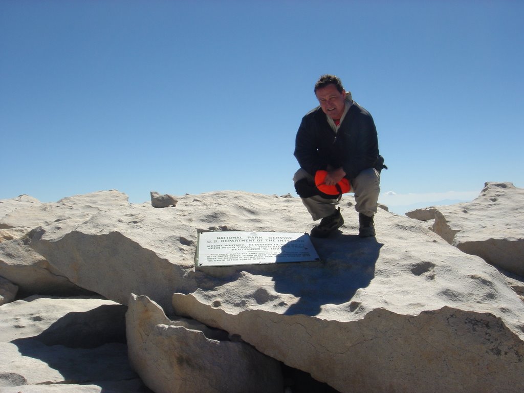

10:40 a.m.: Phase Two--the "getting-down-is-mandatory" part. Eleven miles to go. I give Erin a big hug and say, "Let's do it and get this over with!"
11:10 a.m.: We are stopped by two park rangers on the "backside." One of them asks if we are from the "parking lot" side meaning Whitney Portal. I tell them the trip and group report. We chatted and laughed for 10 minutes.
12:19 p.m.: Erin and I reach Trail Crest. It is literally all "downhill" from here. We slap on more sunscreen to protect us from the reflected sunlight from the rocks in front of us. It starts to warm up so I start to remove the layers of clothing.
1:45 p.m.: We reach the "springs" and fill up our water bottles to put in our Camelbak bladders.
2:00 p.m.: We reach Trail Camp after descending the 97 switchbacks. It is not as windy as this morning. We relay trail conditions to the other hikers. We wish them good luck on their summit.
3:10 p.m.: We pass Mirror Lake and hit the switchbacks before Outpost Camp. I point out to Erin the scenic expanse of Bighorn Park and Outpost Camp below. It is a sight to behold.
3:30 p.m.: We reach Outpost Camp. Not a tent nor a soul around. Abandoned. Another stream crossing and off we go. Usually one would see a park ranger here along the trail. Today was not the case.
3:56 p.m.: We leave the Whitney Zone. The longest 2.8 miles of the hike are ahead of us. We stop at the log crossing for more water.
5:08 p.m.: Done. 17 hours and 5 minutes. My second longest Whitney hike. Erin's ankle did fine. She had problems on San Bernardino Peak, but not this time. My back was bothering me on the descent but nothing major. I think it was due to the weather more than anything.
Erin spots Garv's vehicle in the day use parking lot and I figured he was waiting for us at the Whitney Portal Store. As we came closer to the store, we spotted Garv sitting on the outside patio. Congratulatory hugs and handshakes were exchanged.
We stopped by the Team Bruin campsite to provide them the trail report. I hope my report gives them a slight edge for their hike tomorrow.
Joe, Mike, Garv, Kelly, Horacio, Anne, Erin and I celebrate at the Pizza Factory.
Lessons learned: Never do what I did AGAIN when it comes to chucking gear to save weight!! Bring goggles or change sunglass lenses from dark to clear to shield eyes from wind.
 WE DID IT!
Friday, August 04, 2006
INSPIRATION
"Before the gates of excellence the high gods have placed sweat; long is the road thereto and rough and steep at first; but when the heights are reached, then there is ease, though grievously hard in the winning."
"The heights by great men reached and kept
Were not obtained by sudden flight,
But they, while their companions slept,
Were toiling upward in the night."
"Those on top of the mountain did not fall there."
Thank you, Cheryl, for these quotes. I like all of them. Thank you very much for the inspiration.
Sunday, July 16, 2006
HAPPY 50TH ANNIVERSARY, MOM AND DAD!

The two people who I admire most and have given me all a son could ever ask for are celebrating their GOLDEN ANNIVERSARY today.
Happy 50th Anniversary, Mom and Dad!
Saturday, July 08, 2006
MT. SAN GORGONIO
 Group #1: Ed, Pat, Dave, Jane, Aileen, Frank on top of Mt. San Gorgonio
I hiked to the top of Mt. San Gorgonio (11,501) with 10 other hikers. All but one of us reached the summit. We completed the 15.6 mile hike in 10 hours 30 minutes with ideal hiking conditions.
For the nine that reached Southern California's highest peak, all were their first summits on their first try. Dave and Jane, Michael, Aileen, Pat, Anne, Kristan, Frank, and Ed. Remarkable and incredible people. As for me it was my fifth summit.
My two hiking friends and wilderness permit holders, Dave and Jane, and eight other hikers started our hike around 6:00 a.m. Start of the hike was chilly but tolerable for some. Mosquitoes out in force as usual once exiting the vehicles. Ed arrived in the picnic area 30 minutes before Michael, Anne, Kristan and I arrived around 5:30am.
Trail washout was a concern due to deluge the night before, but the VCT trail was in excellent condition and no snow along the trail. There were only two trees that had fallen across the trail around the 10,400 mark. One was an "over or under" and the other was "around."
One of the hikers had a "bladder" problem. We tried to remedy the situation with some duct tape, but the moisture on the bladder prevented the tape from adhering to it.
 The group and I performing water bladder first aid. That's me with my back towards the camera.
Cumulus clouds started to form at Galena Peak lookout as we neared High Creek Camp. As we neared the 10,000 foot mark, the skies became overcast. However, clouds provided valuable shade as we made our way along the exposed section of the trail above 10,500 feet. Hardly any wind at all along this section. Chilly from the 11,000 up.

Ed, me, and Pat at the last stop at 11,000 feet for another 500 vertical feet in 3/4 miles.
Two summit groups. First group: Dave, Jane, Aileen, Frank, Ed, Pat, and me reached summit around 11:35 a.m. Second group: Michael, Anne, and Kristan reached around noon. All first summits for all nine.
 Me, Ed, Pat and Aileen at the summit. The person in red was not a member of our group.

Aileen, Jane, Dave, Frank and me.
The summit marker was missing due to souvenir hunters probably. A well-fed chipmunk scurried about looking for food.

King Fat Chipmunk sitting on what was the summit marker nearby.
Dark and grey clouds became concern at summit. It was decided to descend back down at noon.
As we past Group #2 on the way down, Michael reported to me that Kelly was having problems with the altitude and was sitting somewhere along the trail. As I sat approximately 300 yards below the Mineshaft Saddle/Vivian Creek junction waiting for Group #2 to come down, I saw Kelly coming up the trail. This was to be his turnaround point. I wish he had made it to the summit, but today was not the day. He made the right decision to turn around.
Our descent was uneventful. Met two rangers and they checked our permit. The last 1.2 miles from VCC to the TH is always a killer on the knees.
Many thanks to Kelly for providing much needed and well-deserved Hansen's sodas for post-hike festivities.
Congratulations to all on their first summit! Job well done!

Somewhere along the Vivian Creek Trail.
Trail notes: Do not trust meteorological reports if they forecast "sunny skies" and beware of cumulus clouds forming. Frequent breaks along sections of the trail key for first-timers. Rest stops: Vivian Creek, Amphitheater, Halfway Camp, Galena Peak, High Creek Camp, Ridgeline. Keep breaks minimal in duration. There are 16 switchbacks between HCC and the ridgeline around 10,000 feet. Why is it that the Mill Creek Ranger Station cannot provide the latest trail or weather conditions for the SGWA? In all my hikes in the SGWA, I have always met rangers on the VCT, South Fork, and San Bernardino Peak trails. Why can't they provide the latest conditions. Plenty of water in the creeks and filtration/purification strongly recommended. There was a bear sighting by Mill Creek by another group of hikers early in the morning.

Subscribe to:
Posts (Atom)